Wondering how to get your bearings before you make a move to Upper St. Clair? If you are relocating from another part of Pittsburgh or from out of town, this township can feel easy to navigate once you know the right landmarks. In this guide, you will get a simple orientation to Upper St. Clair’s layout, daily conveniences, commute anchors, and community touchpoints so you can tour the area with more confidence. Let’s dive in.
Where Upper St. Clair Fits
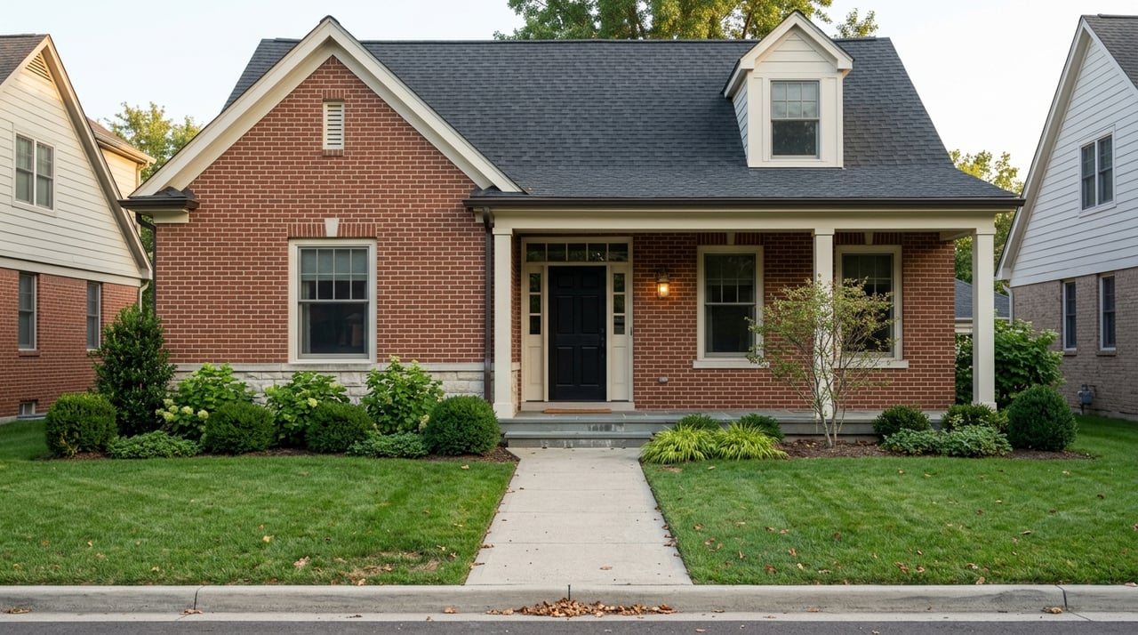
Upper St. Clair is a compact 10.5-square-mile township about 10 miles southwest of Pittsburgh. Township information describes it as a well-planned, well-managed community with established neighborhoods, which helps explain why it often feels organized and easy to learn on a first visit.
If you are new to the South Hills, think of Upper St. Clair as a park-rich suburban township with strong connections to shopping, recreation, and regional job centers. Its size is actually a benefit for relocation buyers because you can cover a lot of ground in a short amount of time.
Start With the Main Anchors
If you only remember three reference points, make them South Hills Village, McLaughlin Run Road, and Boyce Mayview Park. Those three areas give you a practical feel for how daily life in Upper St. Clair is organized.
South Hills Village helps you understand errands, transit, and major roads. The McLaughlin Run Road area helps you see civic and school-related landmarks. Boyce Mayview Park shows you the recreation side of the township.
South Hills Village for Daily Life
For many newcomers, South Hills Village is the clearest starting point. It sits at Route 19 and Fort Couch Road, and it functions as a major retail and mobility hub for the area.
Township new-resident materials point to nearby everyday conveniences like South Hills Village Mall, Whole Foods, Trader Joe’s, and Giant Eagle Market District. If you want a quick snapshot of where errands may cluster, this is one of the most useful places to begin.
Why this area matters
When you are relocating, everyday convenience matters just as much as home style or lot size. Touring this corridor helps you picture the practical side of life, from grocery runs to quick stops on the way home.
It is also one of the easiest places to use as a meeting point during an orientation tour. Because it connects retail, roads, and transit, it gives you an immediate sense of Upper St. Clair’s rhythm.
Transit and Commute Orientation
South Hills Village is also the key transit anchor for Upper St. Clair. Pittsburgh Regional Transit’s Blue Line serves Upper Saint Clair South Hills Village Park and Ride and runs to Downtown Pittsburgh and the North Shore, with stops that include Station Square, Wood Street, and Allegheny.
For buyers who expect to commute into the city, this gives you a straightforward place to test the trip. The schedule also notes park-and-ride garage parking, which can be helpful if you want to combine driving and rail.
Driving routes to know
For drivers, South Hills Village directions identify the downtown route by way of the Fort Pitt Bridge and Tunnel and Route 19 South. South and west approaches use I-79 North to Route 19 North.
You do not need to memorize every road on day one. It is often enough to understand that Route 19 and Fort Couch Road are the clearest reference points for getting oriented during your first visit.
How to Think About Neighborhoods
One of the first surprises for many relocation buyers is that Upper St. Clair is not always marketed through highly publicized neighborhood names. Public-facing township materials do not focus heavily on formal neighborhood branding.
Instead, Upper St. Clair is often easier to understand by school zone and corridor. That means many buyers orient themselves through the elementary and middle school areas, along with major roads and civic landmarks.
School-zone anchors
The district lists these school locations as useful orientation points:
- Baker Elementary School, 2300 Morton Road
- Eisenhower Elementary School, 100 Warwick Drive
- Streams Elementary School, 1560 Ashlawn Drive
- Boyce Middle School, 1500 Boyce Road
- Fort Couch Middle School, 515 Fort Couch Road
- Upper St. Clair High School, 1825 McLaughlin Run Road
The district also notes that elementary boundary lines are approximate guidelines for busing. For that reason, a school-zone map is usually more useful than trying to learn subdivision names too early in your search.
What this means for your home search
If you are comparing different parts of Upper St. Clair, it helps to ask where a home sits in relation to Route 19, McLaughlin Run Road, Fort Couch Road, and Boyce Road. Those reference points often make the township easier to picture than neighborhood labels alone.
This approach can also help you narrow your search faster. Instead of trying to learn every pocket at once, you can focus on the corridors that best match your commute, routines, and preferred access to parks or shopping.
Parks and Recreation Shape the Community
Recreation is a major part of Upper St. Clair’s identity. According to township information, the community maintains more than 700 acres of parks and facilities, including 14 parks, 16 tennis courts, a three-hole golf course, five baseball fields, nine basketball courts, five soccer fields, and a walking trail in Gilfillan Park.
For many buyers, this is one of the strongest quality-of-life features to experience in person. Even a short drive through local parks can tell you a lot about how the township uses space and how residents may spend time outdoors.
Boyce Mayview Park as a key stop
Boyce Mayview Park is one of the biggest recreation anchors in the township, described on current township pages as roughly 475 to 485 acres. The Community & Recreation Center, a 90,000-square-foot facility, is located there.
If you are trying to understand the lifestyle side of Upper St. Clair, this should be on your must-see list. It gives you a strong feel for the township’s recreation focus and its investment in community facilities.
Work Centers and Regional Access
Many relocation buyers are not moving for Upper St. Clair alone. They are also thinking about how the township connects to the wider Pittsburgh region and its job base.
Regional employer information shows a diversified economy centered on healthcare, finance, advanced manufacturing, life sciences, technology, education, and corporate services. Major employers identified in the region include UPMC, Highmark Health, PNC Bank, the University of Pittsburgh, and Giant Eagle.
Why that matters for relocating buyers
In practical terms, Upper St. Clair can make sense for buyers whose work is tied to Pittsburgh’s broader South Hills and downtown employment base. That includes healthcare, finance, education, office, and corporate roles connected to the region’s larger economy.
If your move is job-related, it helps to test both the township itself and the routes you may use most often. A neighborhood can look great on paper, but commute flow and daily convenience are what make it feel workable in real life.
A Smart First Tour of Upper St. Clair
If you are short on time, the most efficient relocation tour usually has three stops. This lets you understand errands, roads, schools, civic areas, and recreation without turning the day into an all-day marathon.
Stop 1: South Hills Village corridor
Start at South Hills Village near Fort Couch Road and Route 19. This stop gives you a feel for shopping, transit access, and one of the township’s most recognizable road anchors.
Stop 2: McLaughlin Run Road area
Next, drive the McLaughlin Run Road school and civic cluster. This helps you understand the township’s internal geography and see how key public destinations are laid out.
Stop 3: Boyce Mayview Park
Finish at Boyce Mayview Park and the Community & Recreation Center. This is the best way to gauge the park and recreation side of Upper St. Clair in one stop.
Bonus tip for commute testing
If time allows, repeat one commute leg during rush hour. You can try the Blue Line from South Hills Village to Downtown Pittsburgh or the North Shore, or drive the Route 19 and Fort Pitt Tunnel pattern to see how the trip feels firsthand.
What Newcomers Usually Notice First
Most buyers relocating to Upper St. Clair notice three things quickly. First, the township feels compact enough to learn without feeling small. Second, daily errands are easy to map around the South Hills Village area. Third, parks and recreation are not just extras here, they are a visible part of the community layout.
That combination can be especially helpful when you are making a move on a deadline. It gives you a simple framework for comparing homes and understanding how each part of the township may support your routine.
If you are planning a move to Upper St. Clair and want help narrowing your search, touring the right areas, or understanding how this township fits into the broader South Hills, Wendy Weaver can help you make the process feel clear, local, and well organized.
FAQs
How should you orient yourself in Upper St. Clair as a new buyer?
- The easiest way is to start with South Hills Village, McLaughlin Run Road, and Boyce Mayview Park, then use school zones and main corridors like Route 19 and Fort Couch Road to understand the township.
What is the main transit hub for Upper St. Clair commuters?
- South Hills Village Park and Ride on Pittsburgh Regional Transit’s Blue Line is the key transit anchor for trips toward Downtown Pittsburgh and the North Shore.
Where do many daily errands cluster in Upper St. Clair?
- Township materials point to the South Hills Village area and nearby options such as Whole Foods, Trader Joe’s, and Giant Eagle Market District as major day-to-day convenience anchors.
How can you understand Upper St. Clair neighborhoods quickly?
- Many buyers find it easiest to think in terms of school zones and road corridors rather than trying to memorize formal neighborhood names.
What recreation features stand out in Upper St. Clair?
- Upper St. Clair maintains more than 700 acres of parks and facilities, including numerous courts and fields, Gilfillan Park’s walking trail, and the large Boyce Mayview Park area with the Community & Recreation Center.